
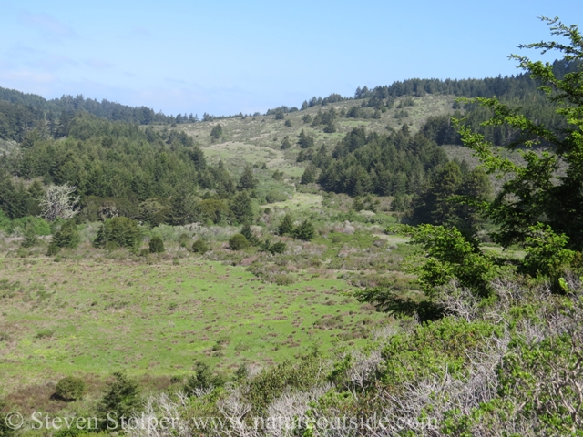
Quiroste Valley
A broken overcast hangs above the ocean with blue sky over the coastal mountains. The wind is calm as we wend our way through the grassland. Quiroste Valley is a tranquil place, where nature delights and history hangs in the air.
I feel privileged to visit Quiroste, a cultural preserve within the California State Parks System. Its 225 acres contain more than 12 archaeological sites that may date back to 6,700 BC. When the Spanish first entered the area in 1769, they named the place “Casa Grande” for the large ceremonial structure they observed.
It’s now an active archaeological site. State sponsored archaeologists work with the Amah Mutsun Tribal Band to study California Indian land management strategies, particularly the use of fire.
As we walk, the archaeologists speak about how native peoples may have managed the landscape using fire. I learn a lot. But what impresses me most is the archaeologists’ approach to exploring the site.
The archaeologists express deep sensitivity toward the descendants of the original Ohlone inhabitants. They want to disturb the site as little as possible. In particular, they wish to avoid disturbing burials. Their strategy is “to not dig.” They rely on remote sensing technology instead of digging test pits and engaging in wholesale excavation.
In a sense, traditional archaeology is destruction. The act of excavation destroys the site itself. The remote sensing technology permits strategic digging. Only scientifically interesting areas are excavated. This preserves the larger site. It also seems more efficient than excavating a wide area hoping to unearth an interesting location. But remote sensing technology is not perfect. So I am struck by the archeologists’ willingness to risk “missing data” in order to adhere to their ethic.
Here are some of the technologies employed at the site and how they are used.
| Magnetometry | The heat from burning causes iron particles in the rocks and soil to align with Earth’s magnetic field. So an ancient cooking fire buried beneath the soil can cause a variation in the local magnetic field. Magnetometry can sense this anomaly up to two meters below the surface. |
| Resistivity | An electrical current is passed through the ground. Air, pottery, and stone have a higher electrical resistance than soil. This technique is helpful for detecting pits and walls buried beneath in the soil. A large pit may be a midden. A smaller pit may be a burial to be avoided. |
| Ground Penetrating Radar | Electromagnetic waves are reflected by changes in density below ground. This technique can be used to locate buried masonry walls, holes, or voids. |
I’m fascinated that cutting-edge remote sensing technology can be brought to bear on archaeological problems. I’m also impressed by the willingness of the archaeologists to accept these techniques. I leave Quiroste impressed by the site, but also with admiration for the people exploring it.
Related Articles on NatureOutside
The Tuibun of Coyote Hills (Part 2)
Mobile Technology and Our Wilderness Experience
For fun facts and useful tips, join the free Bushcraft Newsletter.


Leave a Comment