
British Commonwealth Pacific Airlines Flight 304 departed Honolulu bound for San Francisco. It was October 28, 1953. And as the DC-6 climbed into the night it immediately encountered problems.
Captain Bruce Dickson radioed the tower he was “having a little trouble with one of the props” and was turning back to the airport. But as the airliner approached the field the problem appeared to resolve itself.
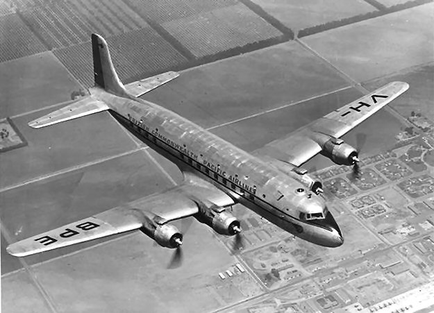
So with its 11 passengers and 8 crew, the Resolution turned east. Its four 2,400 horsepower propellers droning in the darkness as it set out across the Pacific.
The Resolution
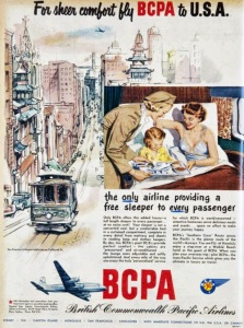
1952 Flyer advertising service to San Francisco
Photo: digitalpostercollection.com
British Commonwealth Pacific Airlines operated the “Southern Cross” route between Sydney and Vancouver. Twice weekly, flights would cross the Pacific with stops at Auckland, Fiji, Hawaii, and San Francisco before finally arriving in Vancouver.
Its four pressurized Douglass DC-6 planes were named for each of Captain James Cook’s historic ships of exploration: Adventure, Discovery, Endeavour, and Resolution.
Captain Dickson, 34 years old, had more than 10,000 hours of flight time and had flown the route for many years. His 28 year old copilot, Frank Campbell, was also an experienced airman.
Among the passengers was American pianist William Kapell. He had just completed a 37-concert tour and was returning home. The 31 year old was considered one of the most promising pianists of his generation. Kapell felt he had been maligned unfairly by music critics during his tour. Before he boarded the plane at Sydney, Kapell told Australian reporters “This is goodbye forever—I shall never return.”1
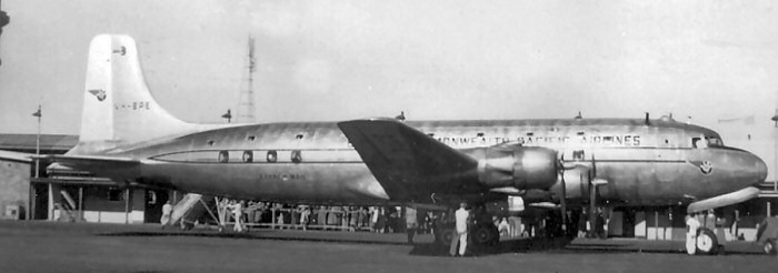
Resolution on the Ground
Disaster in the Fog
We may never know exactly what happened next. Captain Dickson contacted San Francisco at 8:07 AM, as Resolution approached the coastline. He began to descend from 11,500 feet. Procedure dictated that he remain at least 500 feet above the cloud tops, which were reported at 1,700 feet.
At 8:39 AM, a radio transmission from Resolution advised air traffic control that they were over the coastal town of Half Moon Bay, California, 500 feet above the clouds. What we know today is that the airplane was actually several miles south of their reported position. They were headed straight for the Montara Mountains that stretch across the center of that part of the San Francisco Peninsula.
At around 8:42 AM, Resolution transmitted “Air Pacific Easy, Roger, southeast, turning inbound.” They were never heard from again. Repeated radio calls from the airport were met with silence.
The Search for Survivors
A search was mounted almost immediately. At 10:30 AM a Coast Guard search plane spotted the burning wreckage of the airliner in dense forest 1,950 feet above sea level. Fuel from the plane ignited forest fires over a half-mile area.
Resolution appears to have clipped a tree just 300 feet short of clearing the tops of the mountains. It disintegrated over a 600 yard swath, burning trees and scrub before smashing into the side of a deep ravine.
An Air Force helicopter with a doctor onboard landed a quarter of a mile from the crash site. Three airmen parachuted into the rugged terrain in the hope of reaching survivors. But one of the rescue workers said2:
We had shouted as we approached, hoping to hear an answering call. But there was only the roar of flames, the low drone of helicopters circling over slowly and, beneath, only the silence of death.
There was hardly a piece of wreckage big enough to identify. But we did spot motors and part of the tail.
Trees were chopped off as if they had been sliced by a huge knife.
Parts of the plane were melted into unrecognizable lumps.
When we saw the charred wreckage scattered over a mile, we knew that we had fought through fog and fire and jungle in vain. There could be no survivors.
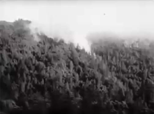
Forest fires burning after the crash
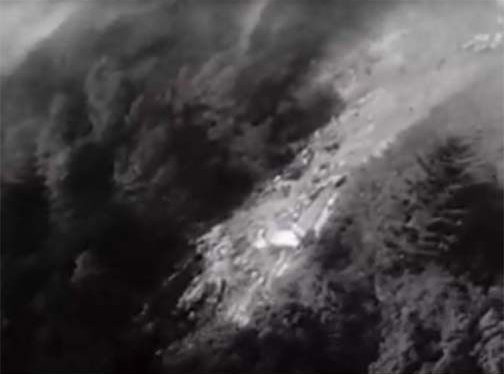
Debris field from crash
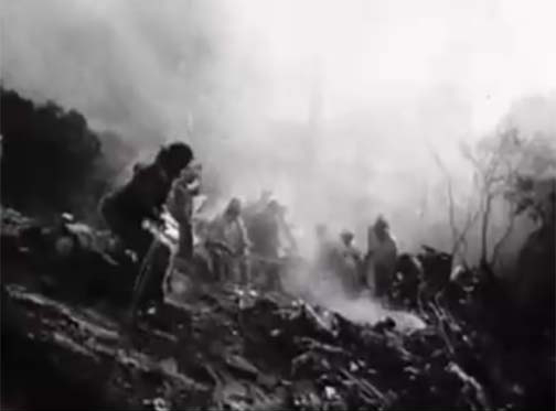
Rescuers at crash site
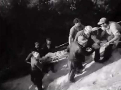
Removing the bodies
Historical Hiking
We often hike to waterfalls, mountain tops, and beautiful views. But some of the most rewarding hikes involve the rediscovery of local history. The Santa Cruz Mountains, where I reside, are dotted with long abandoned shingle mills, logging camps, and farmsteads from the 1800’s and early 1900’s. Each tells a story. There is something timeless and awe inspiring about visiting a ruin and imagining what it is like to live in that time.
I want to share a hike I did in 2013, to the remains of the Resolution crash site. It lies in what is now a public Open Space Preserve. The heavily forested area is especially beautiful when it rains. Our recent heavy rains in California prompted me to recall this hike and share it with you.
I was there in similar rainy conditions…
Hiking to the Resolution
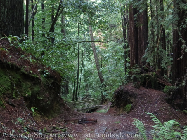
At lower elevations, the forest is dominated by giant Redwood trees. Near the crash site, Oak, Madrone and Douglass Fir dominate
I went day hiking through El Corte de Madera Open Space Preserve in Northern California’s Santa Cruz Mountains. We have experienced heavy rains the past couple of weeks and today was a foggy/misty/cloudy day after heavy overnight rain. The steep mountain hillsides are blanketed by dense oak/pine/madrone and redwood forests.
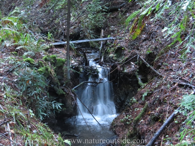
After a rain is a terrific time to hike in a forest
The location of the crash is not marked on any maps I know of. Although I was told that wreckage is still visible from the trail, I hiked it several times before without seeing any. Rangers told me that the crash site has been pretty well picked-over through the almost 60 years since the crash. So I was not hopeful as I set out from the trailhead.
The heavy rains must have unearthed more wreckage, or I might have just been looking in the right direction this time. But I found aircraft remains in a steep ravine visible below the trail. Here are pictures of a small part of the aircraft remains:
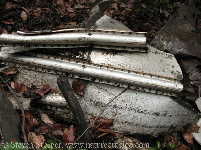
Remains of the aircraft
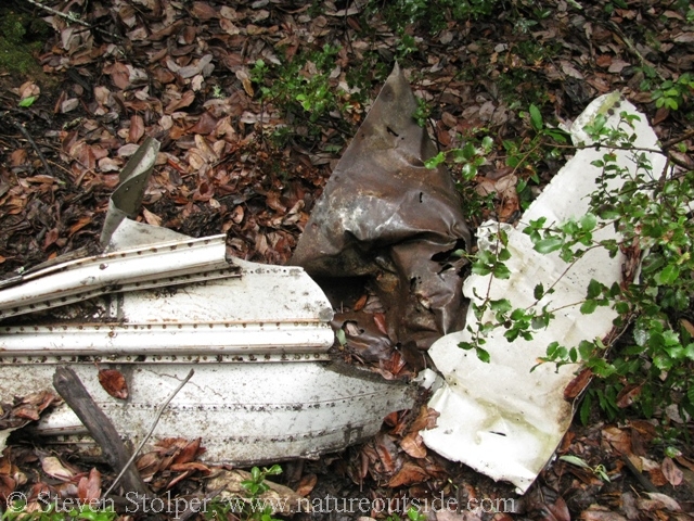
The site is obscured by the steep hillside and oak trees
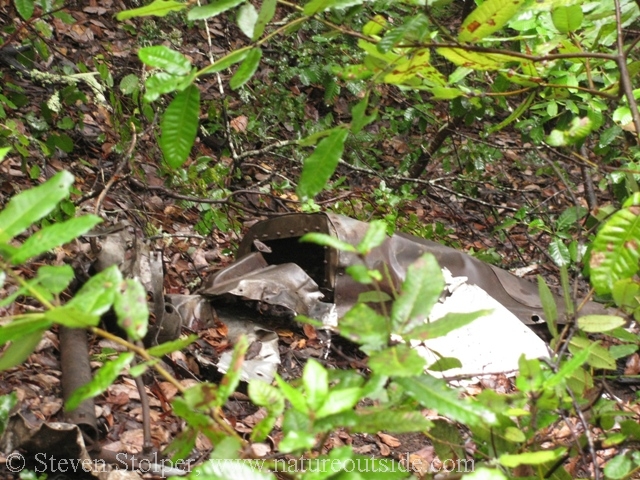
An engine cowling?
It was evident that the wreckage was recently disturbed by people. On my climb back to the trail, I found a cairn made from small components (melted metal, valves, hydraulic line, etc.). I do not know whether it was the right thing to do, but I returned all these items to the wreckage below. I felt it was wrong to disturb a crash site where people lost their lives.
About 1.5 miles from the site, the Open Space Preserve and a historical group erected a memorial to the lost flight. Nearby the rock were laminated Australian and American flags dated October 29, 2012. This was the last anniversary of the crash.
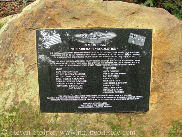
Memorial to the 19 people who lost their lives
From my lunch site I took a picture facing west. What you don’t see in this picture is the Pacific Ocean just beyond the farthest hills. You can see how, finally making landfall, my current position was the first high terrain the flight encountered at about 2,500’.
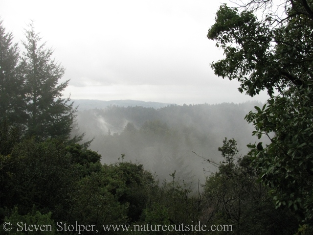
The cloud cover over the coastal range – similar to the day of the crash
Do a Historical Hike
Sites of minor or local historic significance make great hiking destinations. They can highlight or add interest to any outdoor trip. To come upon this wreckage in the silent misty forest was a treat. I feel fortunate the wreckage was preserved enough to appreciate. I hope my fellow hikers will leave it undisturbed.
Have you done any “Historical Hiking”? Let me know in the comments below.
References
4. Accident Investigation Report
Other Hikes on NatureOutside
The High Sierra Loop – Sunrise Camp to Merced Lake
If you enjoyed this article, you may like others in the Trips Section.


I really enjoyed reading about this plane crash after our Hike to the site. Thanks Steve. Fantastic historical photos.
Jumana
I’m glad you enjoyed the article, Jumana.
On October 29,2013 I participated in the hike on the 60th anniversary of the crash.I had the honor of reading something I had prepared about William Kapell,the famed concert pianist,who was among the 19 people who perished
Shane, it’s terrific you were able to participate. If there are future commemorations, I will highlight them on NatureOutside.
Thanks for this. I was a senior in high school (12th grade) at Menlo-Atherton. I don’t remember this at all. Too involved in football. From 1966 to 1974, when I was city editor of the Redwood City Tribune, we reported on several crashes in those woods. One time inmates from the county jail were used in the search and found the wreckage.
Dennis, thanks for the background information. I had no idea other crashes occurred in that area.