
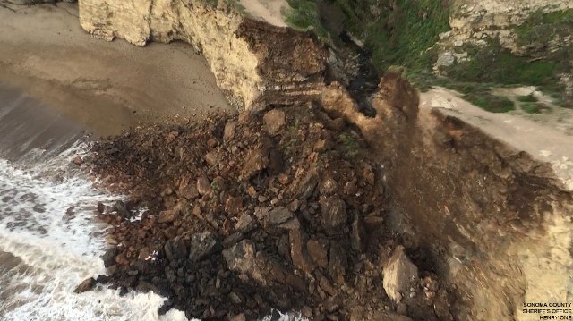
Arch Rock after collapse.
(Photo by Sonoma County Sheriff’s Office, Henry One helicopter)
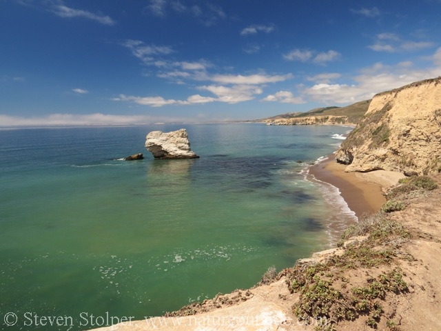
Arch Rock is breathtaking. The sandstone formation juts into the pacific 70 feet above the crashing waves. The trail spans a dramatic arch that hikers must cross to reach the impressive bastion. The reward is a spectacular view from a dizzying height. The 8.2 mile round trip from the Bear Valley Visitor Center is the most popular hike at Point Reyes National Seashore.
I was at Arch Rock two years ago. I snapped this picture from where the trail leaves the cliff face and arches out to sea. I marked the portion of the trail that collapsed. You can see people in the distance, which gives a rough idea of the scale of the disaster.
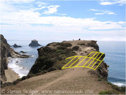
Arch Rock from my last visit. I annotated the area that collapsed.
Large fissures appeared on March 19, and the park acted quickly. They closed the trail to visitors and posted signs at the visitor center to warn them that the cliff was closed. Four notices along Bear Valley Trail announced that it was too dangerous to walk on the cliff.

Fissures formed on March 19. Looking back toward where I took my picture. (Photo by NPS)
On March 21, two hikers walked past the signs and were standing along the trail when the cliff gave way. Both fell with the collapsing rock.
Emergency responders evacuated both hikers from the scene. But one died shortly after evacuation. The other’s injuries are not life threatening. The names of the hikers have not been released pending notification of their families.
Here are some additional pictures that show the part of the trail that collapsed and the arch that was underneath it.
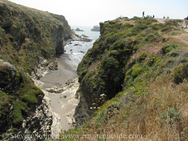
Looking at the “left” side of Arch Rock. You can see the top of the arch, below the trail.
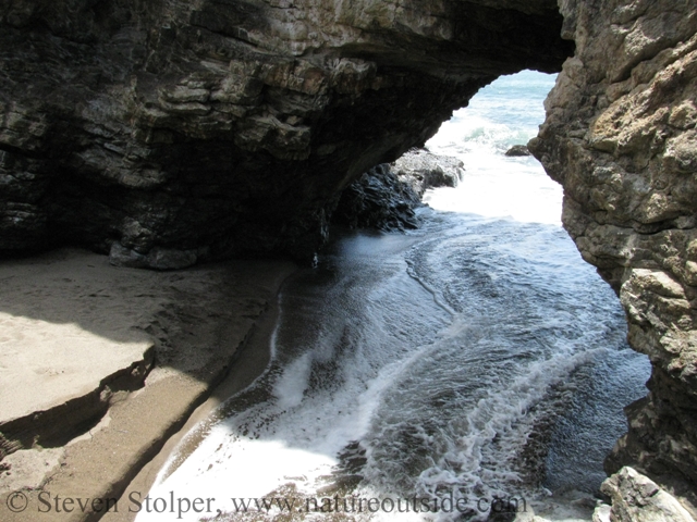
The arch underneath the trail.
Here is a last view from the trail, near the collapse. I remember feeling exhilarated by the elevation and the bracing wind off the ocean.
View “right” from the trail to Arch Rock
I hope you will join me in sending your thoughts and sympathies to the family of the deceased hiker, and wishes for a speedy recovery to the hiker who was injured.
Related Articles on NatureOutside


We were there 3 weeks ago and saw the crack in the rock before any signs were posted. My fiance said it looked dangerous, but I thought she was over reacting. Maybe now I’ll take her more seriously.
Paul — Thank you for your comment. I’m glad you were not harmed.
I always hike BV in the mornings, before the “tourists” .
I was there on the 14th, the fissures were only 2″ by 8″ or so. But they hadn’t been there the month before. At least not as noticeable.
I knew something was wrong with the trail when they were that big. I forgot to mention it at BV HQ; I was too tweeked about the rude people who parked inthe RV/bus/trailer lot.
If you didn’t know there was a geologic arch you were walking over, the warnings wouldn’t have made any sense.. You would have never understood the danger.
Debbie, you make a good point. Many hikers are visiting the park for the first time. They may be unfamiliar with the trails and not recognize the gravity of certain warnings.
My understanding is that the park closed the single-track leading from the Bear Valley Trail to Arch Rock before the collapse. And there were signs along the BV trail and a sign on the spur leading across the arch. It is very sad this happened. But I’m glad you were safe on your March 14 hike.