
Glen Aulin means “beautiful valley”
This post is part of a series about my hike on Yosemite’s High Sierra Loop.
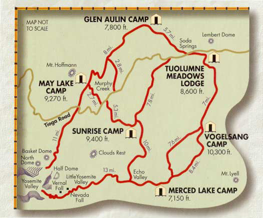
Tuolumne Meadows Lodge to Glen Aulin
Starting Elevation: 8775 ft. (2675 m)
Ending Elevation: 7800 ft. (2378 m)
Approximate Mileage: 9 miles (14.5 km)
Hiking Counter-Clockwise
High Sierra Loop
Starting at Tuolumne Meadows Lodge, you can hike the loop clockwise or counter-clockwise. But there is a big advantage to going counter-clockwise. The elevation actually decreases from 8,600′ to 7,800′ on your first day. As the map above shows, hiking in the opposite direction means climbing from Tuolumne to Vogelsang. That’s a rough first day! You climb from 8,600′ to 10,300′ and end up sleeping over 10,000′ on your first night. So there are definitely benefits to hiking counter-clockwise, as we did.
The relatively short, gently descending hike is essentially a “Hudson’s Bay Start”. Growing up in New York, I learned about this practice in high school history class. When setting out for the season, Canadian fur trappers paddled their canoes only a short distance on the first day. This gave them a chance to “shake out” their equipment and figure out if they forgot anything vital. If there were any problems, it was a simple matter to return the short distance to the start. This leg of our trip served the same purpose.
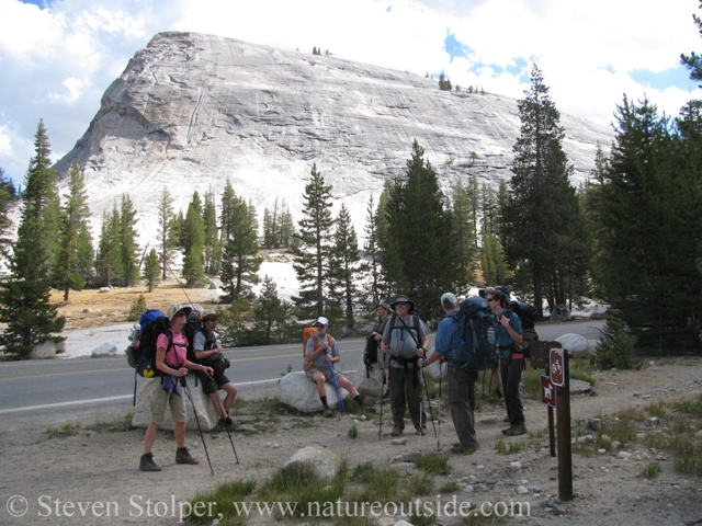
Assembling before crossing Hwy. 120 near Lembert Dome. I am the farthest person.
Echoes of the Miwok
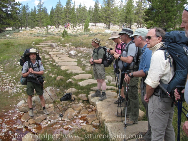
We stopped briefly at the foot of Lembert Dome to examine some ancient bedrock mortars. They are a reminder of the Sierra Miwok who inhabited this area. The Miwok would have used the mortars to grind acorns into meal as a step in making them edible.
During the summer months, the high country would provide food and resources for the native people. It also occurs to me that nearby Tioga Pass could have provided trade access to the people of the Mono Basin on the Eastern side of the Sierra. So finding bedrock mortars adjacent to Tuolumne Meadows makes perfect sense.
Tuolumne Meadows is relatively “crowded” with tourists. This is because of its beauty and its location adjacent to Tioga Pass Road (Hwy.120). Although I recognized the bedrock mortars instantly, I was pleased that they remained unnoticed by the casual tourists. Sites like this are considered sacred by those with cultural ties to them. These were hiding in plain sight, unmolested. For that reason I do not include any pictures of them in this post. If you are interested in learning more about bedrock mortars, here is a post that describes them.
Soda Springs
Soda Springs is a fascinating geologic feature in Tuolumne Meadows. Pools of carbonated water percolate into the meadow from deep within the earth. Calcium encrusted rocks surround the rust-colored pools and a faint whiff of sulfur permeates the air. Standing on a raised stone boardwalk, I could see bubbles regularly appear in the pools like warming ginger ale.
Ranger James reminded us that we were standing on ground that was raised from the ocean floor millions of years ago. Calcium carbonate, the remains of ancient sea creatures deep within the earth, combines with water leaching from above to generate the carbon dioxide that bubbles up through the pools.
Soda Springs. I am standing to the right of Ranger James.
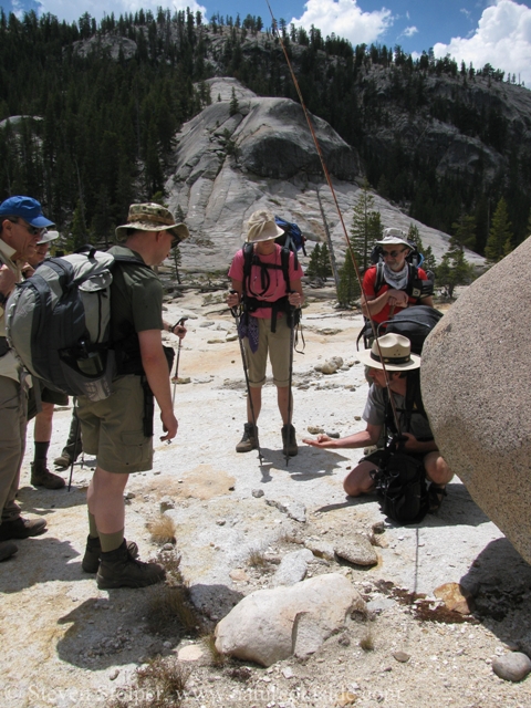
A Contrast in Packing
In the picture above, you can see how I packed for the trip. The park advised, and rightfully so, that it is better to carry heavy weight in a larger pack than in a smaller one. In other words, it is harder to carry 7 days worth of gear shoe-horned into a daypack than it is in a backpack with a full suspension. You can see that all the other hikers are carrying full internal-frame packs.
Unfortunately, my backpack is a 1990’s-era clunky external frame pack. I love the pack, but because of my short stature it does not carry well. This is despite my customizing it with a shorter frame and smaller diameter hip-belt. Rather than spend for a new pack, I elected to use a Kelty Redwing pack I already owned. I used it for years as a large daypack. Its 3100 cubic-inches swallowed all of my gear as well as extra gear I carried when leading outdoor trips for inner-city children.
The Redwing fits like it was made for my body. It has aluminum stays and a beefy hip-belt to carry heavier loads. The challenge was limiting my gear to between 25-30 lbs and fitting it inside the pack. If I could do this I would have a comfortable pack whose small size would allow me to be agile on the trail.
This is what I did. I carried shorts and two pairs of convertible pants, with enough polyester shirts to get me halfway through the trip. I would reuse my outer hiking socks, but change-out the lightweight polypro sock liners. I did not skimp on warm clothing. Being cold in the mountains is no fun. I anticipated washing my clothes halfway through the trip.
I also carried rain gear and a sleeping bag liner to use with the beds in the tent cabins. On the exterior of my pack I secured neoprene booties to use at river crossings. I carried one-liter and half-liter nalgene bottles.
Ranger James went in the other direction. I was amazed that he hiked with a full pack, a camera suspended around his neck, a lens case in one hand, and his fly rod in the other. Our guide could not have been more than an inch or two taller than I was. I was very, very impressed.
On the Trail
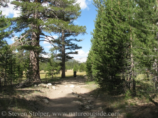
On the trail. Meadows to our left.
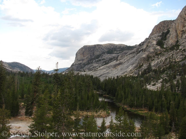
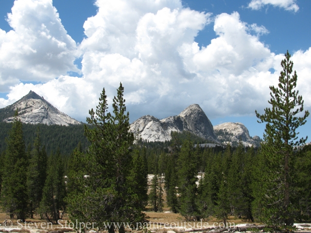
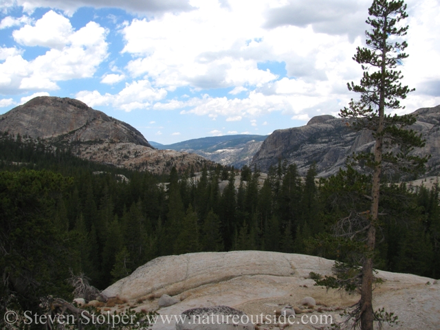
We left Tuolumne Meadows and the tourists far behind. We hiked through lodgepole forest and disturbed a coyote who was hunting along the trail. Following the Tuolumne River, we were treated to terrific views across the meadows of Unicorn Peak, Cathedral Peak and Echo Peak. Even in July, there was a lot of snow at the higher elevations.
There was still plenty of snow on the ground in July
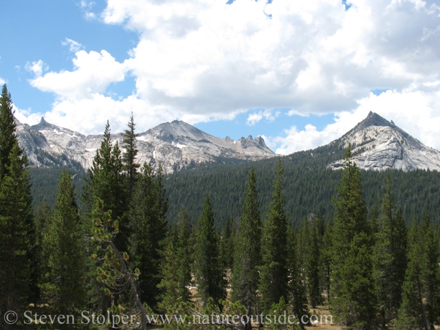
The granite domes and peaks rise from the meadows
It felt good to soak my feet in the ice cold river. Notice the storm clouds approaching.
It was a hot day and it felt good to take a break to soak our feet in the ice cold water. We climbed a bit and Ranger James gave a geology lecture while showing us samples of the granodiorite rock that gives Yosemite its dramatic topography.
Our first climb.
Ranger James shows us granodiorite. Another view of my pack.
Mountains Make their Own Weather
The weather was changing. The air felt heavy and ominous clouds appeared to the southwest. Mountains make their own weather. I’ve heard that saying for many years. It was hammered permanently into my psyche during a multi-day trip in Glacier National Park. My friends and I raced desperately to beat a thunderstorm over a high mountain pass.
So it was not surprising when the sky opened up. Afternoon thunder showers seem common during the summer at high altitudes. The air temperature remained high as we were swept by intense rain. Murphy packed my gear for the trip – my rain jacket was at the bottom of my pack. Drenched and windblown we continued our hike. Mountains make their own weather.
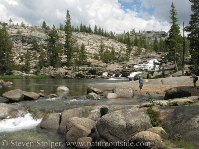
The Cascades
The trail began dropping parallel to the Tuolumne River. We reached a series of cascades just as the rain abated.
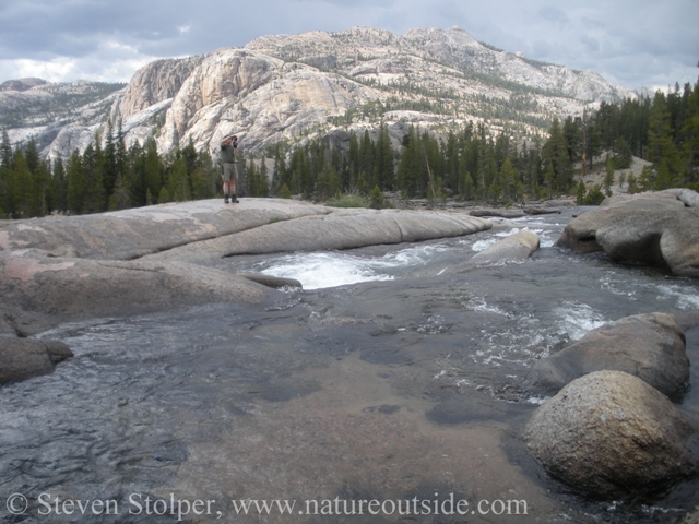
Resting at the cascades
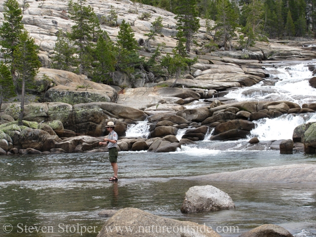
This is the only time I did not see Ranger James land a fish.
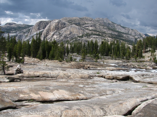
Looking downstream. Notice the passing storm clouds.
Here is me for scale. Pictures do not fully capture the enormity of the terrain
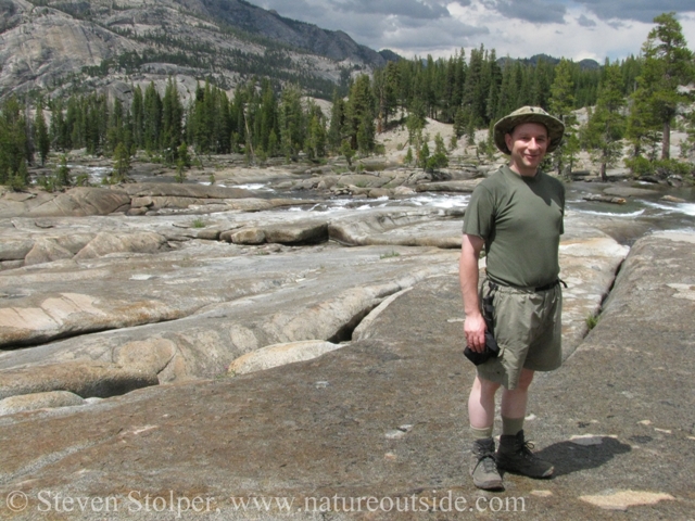
Me with camera pouch (kept on hip-belt) and my trusty Fallkniven F1.
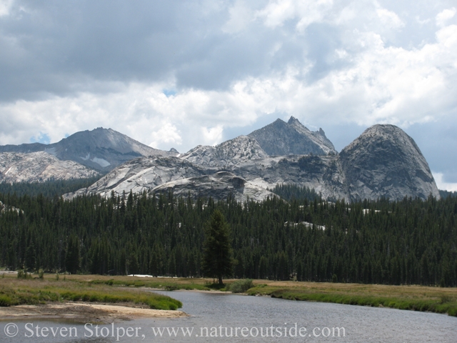
Glen Aulin
I think Glen Aulin is one of the most beautiful stops on the hike. Glen Aulin means “beautiful valley” (Gaelic). The Tuolumne River flows alongside by the camp, which is set beside a swimming hole at the bottom of a stunning waterfall. It was a great way to cool down after our hike.
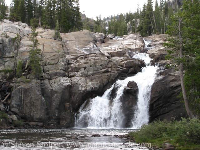
Waterfall and swimming hole alongside camp.
Glen Aulin and the river below camp.
The view downstream is incredible and I scrambled down the granite hillside to walk beside the river. I found the motherload of ripe blueberries and had an small impromptu snack before dinner. I left most of them for the wildlife to enjoy.
The End of a Perfect Day
After dinner, we assembled on a nearby promontory to watch the sunset. Ranger James’ theme for the trip is that there is “Art in everything.” He painted the setting sun as we dangled our feet over the cliff edge and watched the play of colors across the granite cliff face. It was like a serene drive-in movie. The perfect end to a perfect day.
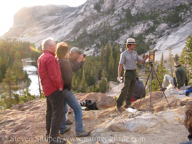
Plein air painting, other lodgers at the camp look on. I am looking at the sun setting over the valley below.
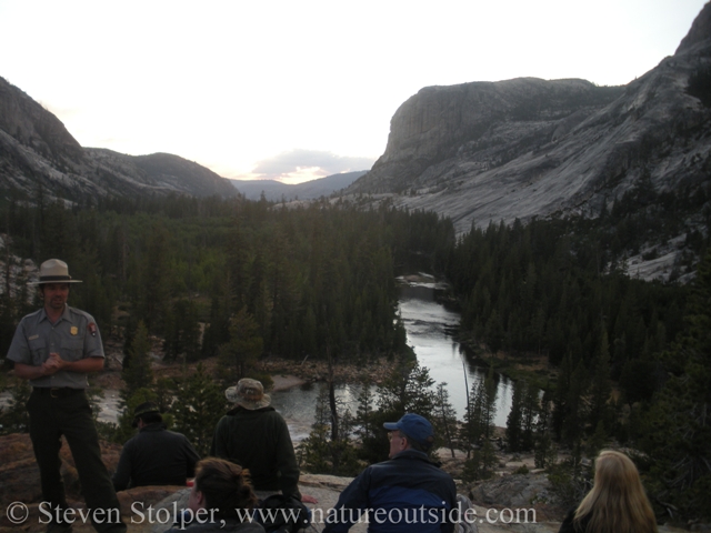
Stories at sunset bring the day to a close.
The High Sierra Loop – Introduction
Day 0: The High Sierra Loop – Arrival Day
Day 2: The High Sierra Loop – Glen Aulin to May Lake
Day 3: The High Sierra Loop – May Lake to Sunrise Camp
Day 4-5: The High Sierra Loop – Sunrise Camp to Merced Lake
Day 6-7: The High Sierra Loop – Merced Lake to Vogelsang
If you enjoyed this post, you can read about other trips in the trips section.


I was thinking about signing up for the High Sierra Loop and stumbled on your delightful account. Now I am more serious about signing up next week.
BUT I must raised the question about the BRMs. It seems unlikely that they were made while grinding acorns, as there are no oak trees at that elevation, unless they were packing them up from Yosemite Valley.
Also, you attribute them to MAN but I believe that work was most often done by WOMEN. 🙂
Anyway, thanks for making this and now I’m going to go back to reading.
Jennie, thank you for your comment. I have been told that they brought acorns up from lower elevations. And you are correct, women traditionally ground the acorns and leached them to remove their tannic acid.
I hope you get a chance to hike the High Sierra Loop. I think you will have a wonderful time.