
This post is part of a series about my hike on Yosemite’s High Sierra Loop.
Sunrise to Merced Lake
Starting Elevation: 9400 ft. (2865 m)
Ending Elevation: 7150 ft. (2179 m)
Approximate Mileage: 9.5 miles (15.5 km)
The Road Not Taken
Two roads diverged in a yellow wood,
And sorry I could not travel both
And be one traveler, long I stood
And looked down one as far as I could
To where it bent in the undergrowth;
Then took the other, as just as fair,
And having perhaps the better claim,
Because it was grassy and wanted wear;
Though as for that the passing there
Had worn them really about the same,
And both that morning equally lay
In leaves no step had trodden black.
Oh, I kept the first for another day!
Yet knowing how way leads on to way,
I doubted if I should ever come back.
I shall be telling this with a sigh
Somewhere ages and ages hence:
Two roads diverged in a wood, and I—
I took the one less traveled by,
And that has made all the difference.
– Robert Frost (1874–1963)
Mountain Interval, 1920.
Bushwhacking
I awoke excited for the day. The night before, Ranger James had explained that today we were going to bushwhack. When you bushwhack you abandon the trail to traverse wild, uncultivated country.
Even in Yosemite’s High Sierra, trails remind you that many have gone before. This was a chance to finally satisfy my curiosity! Instead of watching Yosemite’s ineffable beauty slide silently by, we will plunge directly into the wilds beyond the trails.
But not all of us would be making the trip. The trail that leaves Sunset Camp describes a long, descending dogleg. Our planned route would cut the dogleg by striking out across the meadow and descending a steep water-carved canyon. The far end of the canyon opens onto a steep granite slope. It was the steepness of the slope that prompted Ranger James to split the group. People with an aversion to heights or unsure of their balance were offered the chance to follow the trail. We arranged a rendezvous point on the trail at the bottom of the slope. Half our party elected to follow the trail, led by several strong and competent hikers.
Despite my aversion to heights, I gladly joined the five others on the cross-country route. Long ago, I realized that it isn’t the distance above the ground that disturbs me, it is the exposure. Exposure is a technical term in rock climbing. It refers to the distance one has to fall before first contact with the ground. Another definition I have heard is, “It’s the amount of air under your rock shoes.” In the case of a steep slope, there is little exposure because there is no sheer drop.
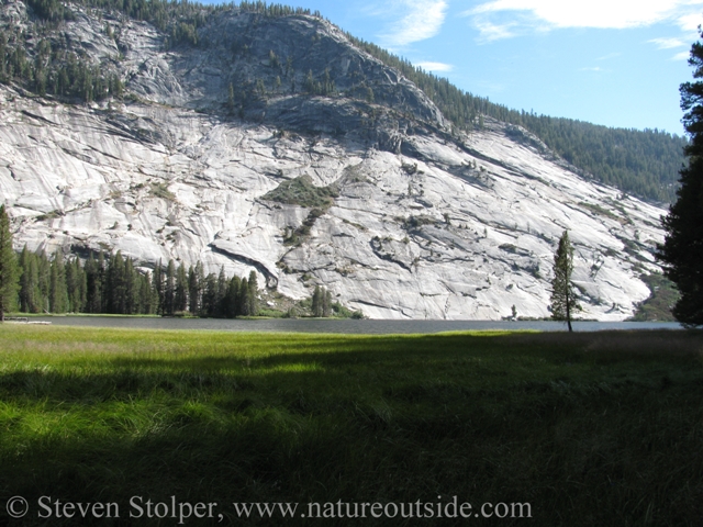
We set out across Long Meadow for the canyon.
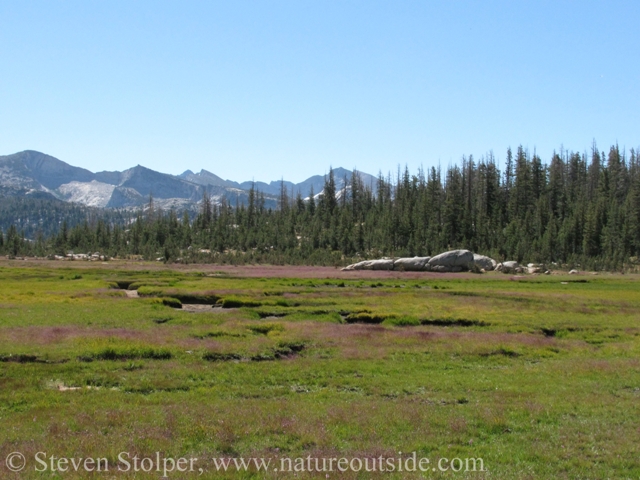
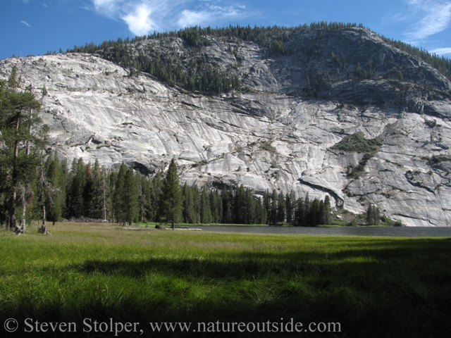
Long Meadow at Sunrise Camp
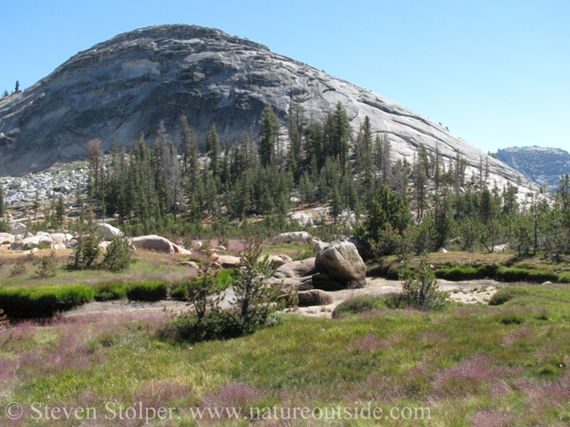
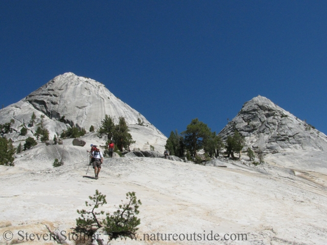
Dramatic granite domes surround the meadow
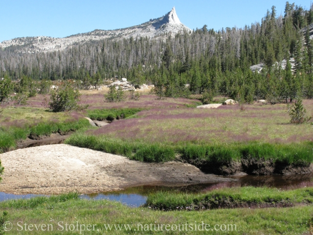
Bushwhacking through Long Meadow
The canyon itself was somewhat unremarkable. But when it opened onto the steep granite slope, the group let out exclamations of amazement.
Jayne Mansfield’s Breasts
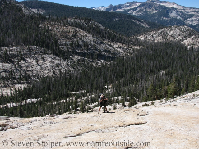
We exited the canyon at the top of an astounding slope of solid granite. Ranger James had not exaggerated its steepness. The view was exhilarating!
Photographing Ranger James (down-slope) photographing us
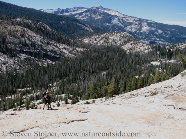
Another shot down-slope
Admiring the view
James explained that the rock formation we perched on was named, Jayne Mansfield’s Breasts. The canyon we emerged from was literally and geologically cleavage!
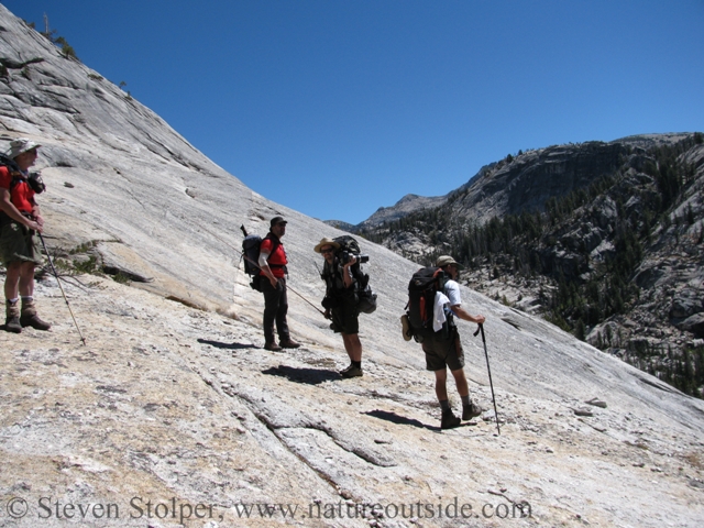
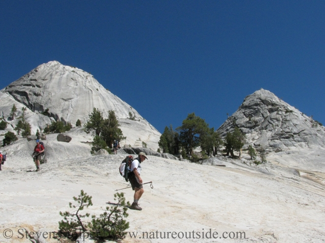
The steep slope was not to be taken lightly. Whenever we attempted to walk down-slope, our bodies gathered momentum at an alarming rate. Scree, small loose stones covering the surface, made the footing even more treacherous. A moment’s inattention and we could find ourselves tumbling head-over-heels down the rocky cant.
We negotiated the steep incline by making our own switchbacks. We traversed the slope laterally back-and-forth, descending about 40 feet with each traverse. Body control was important, and I made sure to limit my momentum and keep my weight over the soles of my feet.
Descending the incline by making switchbacks
It was important to limit our momentum and keep our weight over our boots.
When we reached the bottom we posed for pictures. In childish good nature, many of them show our hands cupping Ms. Manfield’s… um, formation.
Safely at the bottom of Jayne Mansfield’s Breasts
Hidden Falls
At the trail we rejoined our compatriots. They arrived just minutes after we reached the bottom of the slope. Together we followed the trail as it paralleled Echo Creek. Not long after the trail junction for Half Dome, we left the trail again. A game trail through a heavily vegetated area led us back to Echo Creek. The river, like us, had descended all the way from Long Meadow.
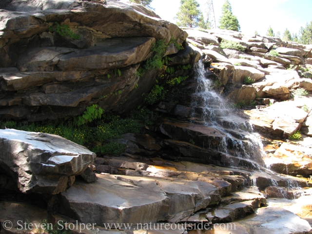
A beautiful waterfall hidden away from the trail
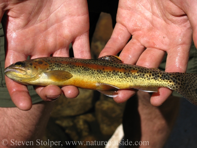
Ranger James works his magic. Golden trout (Oncorhynchus mykiss aguabonita)
Climb to camp
Not long after the falls, the trail began to climb alongside the Merced River. A series of pools provided a much needed respite for our dusty group. By this time, we were all quite weary from the almost nine miles of hiking.
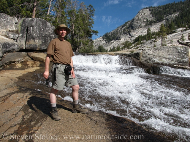
Pausing to refresh at the Merced River
The trail slackened its climb as it reached the north shore of Merced Lake. We were delighted to reach the camp at the far end.
Merced Lake (East)
Merced Lake
Second Day
Merced Lake Camp is the oldest and most remote of the High Sierra Camps. It is also the largest. We spent our “layover day” at this camp to regain our strength before the strenuous climb to Vogelsang the following day. We did laundry, swam, and listened to Ranger James passionately lecture on the High Country’s insidious, ravenous, invasive trout.
But we also had homework to do. Ranger James, an artist, provided each of us with pastels and sketching paper. His goal was to “slow us down” so we could see small details in the nature around us. We had been walking through enormous vistas, and now James wanted us to practice focusing on small details. Drawing forces you to do that. You must notice objects in a very detailed way in order to draw them.
With James’ permission, I declined drawing in favor of a more “bushcrafty” art project, which is a subject for another post.
One thing that gave me great pleasure at Merced Lake was watching an osprey hunt for fish. Later that day, I happened to glance at the sky and saw a golden eagle chasing the osprey, which had a fish grasped tightly in its talons. Despite the osprey’s valiant effort, the eagle eventually harried it into dropping its fish. I was amazed to see the eagle swoop down to pluck the fish from midair before gliding away with its trophy.
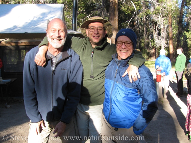
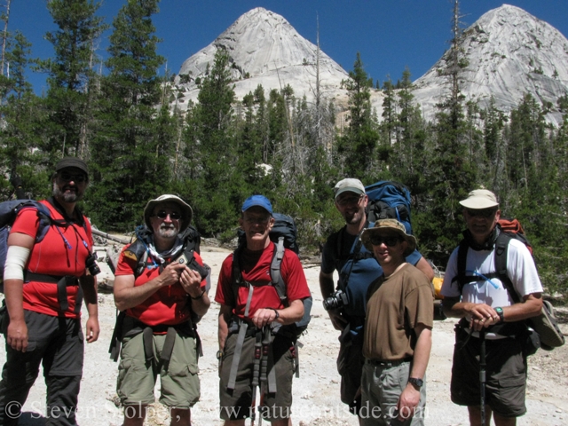
Clowning around at Merced Lake Camp. I always want to be the tallest, but the photographer exposed my trick.
Next: Merced Lake to Vogelsang
The High Sierra Loop – Introduction
Day 0: The High Sierra Loop – Arrival Day
Day 1: The High Sierra Loop – Tuolumne Meadows to Glen Aulin
Day 2: The High Sierra Loop – Glen Aulin to May Lake
Day 3: The High Sierra Loop – May Lake to Sunrise Camp
Day 4-5: The High Sierra Loop – Sunrise Camp to Merced Lake
Day 6-7: The High Sierra Loop – Merced Lake to Vogelsang
I hope you liked this post. If so, you may be interested in others in the trips section.


Fond memories of the loop trail. Thanks for pictures. Nice work.
It sounds like you had as much fun on your trip as I had on mine. You’re welcome, Jeff.