
This post is part of a series about my hike on Yosemite’s High Sierra Loop.
May Lake to Sunrise Camp
Starting Elevation: 9270 ft. (2825 m)
Ending Elevation: 9400 ft. (2865 m)
Approximate Mileage: 8.25 (13 km)
Mirror, Mirror…
I rose early before breakfast and grabbed my camera. The muffled clinking of utensils chimed from the camp kitchen as I quietly slipped away. The warm, still air promised a hot day to come. As I wandered the shoreline of May Lake in silence, I felt like the only creature stirring on the planet.
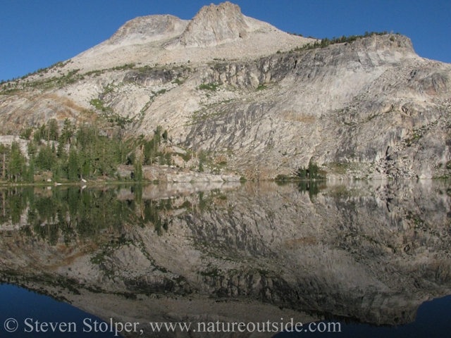
May Lake Camp sits conveniently beside its namesake body of water. When I arrived the evening before, dusty and tired, I soaked my feet in its shallows. The chilly water soothed my aching feet and drew the heat from my legs. But I wasn’t the only one with this brilliant idea. The lake resembled Central Park as every resident of the camp soaked, splashed, and waded in the shadow of Mt. Hoffman (10,856’).
My plan this morning was to enjoy the tranquility of the lake in solitude. Maybe they should have named it, “Mirror Lake”?
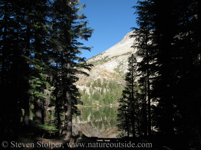
May Lake through the trees
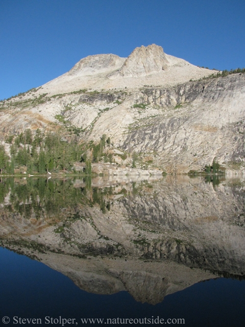
Mt. Hoffman (10,856′) reflected in May Lake
An abstract painting?
Back in civilization
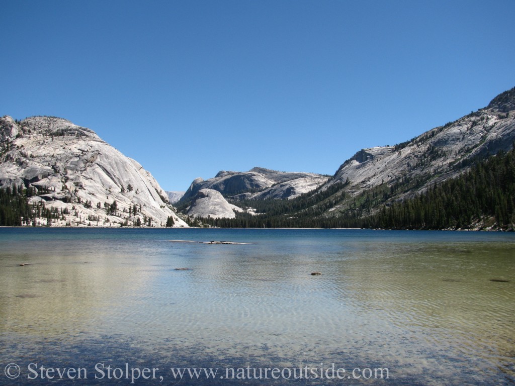
Our group departed after breakfast, descending from the ridge on which the camp is perched. The descent was unremarkable. But we soon began to get tantalizing glimpses of Tenaya Lake, an important waypoint on our hike.
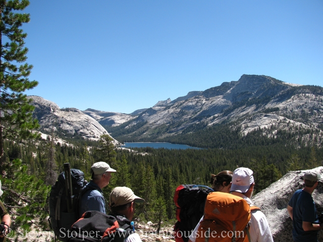
Tenaya Lake from afar
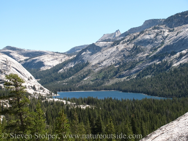
Tenaya Lake
When we reached the bottom of the valley, the trail deposited us at a parking lot complete with a paved access road. It was a little jarring to see the signs, picnic tables and other man-made edifices. We were greeted cheerfully by wranglers preparing a mule train to carry supplies to the camp, now above and behind us.
Before reaching Tenaya Lake, we must cross Tioga Pass Road (Hwy. 120). Then we hike alongside it to the lake. After three days at nature’s pace, the cars on Tioga Pass Road looked supersonic! We crossed the highway without incident and continued on to the lake.
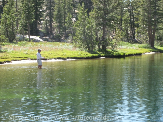
Walking on Water
I had driven past Tenaya Lake on Hwy 120 numerous times. But I never stopped. I figured that a large lake, so easily accessible, would be mobbed by tourists. I would breeze by the parked cars lining the highway on my way to more remote regions.
But today was different. It was early morning of a mid-week day. I could only see one or two people in the distance. We practically had the lake to ourselves.
Ranger James surprised me. Barely breaking stride, he walked right into the crystal clear water and kept on going! It turns out that this end of the lake is shallow. Finding a long, flat rock he stepped up onto it and surveyed the scenery with his camera. To the casual viewer it appeared as if he was standing on water! Slipping off our boots, the group joined him in the shallows.
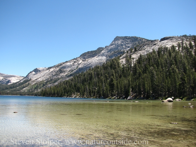
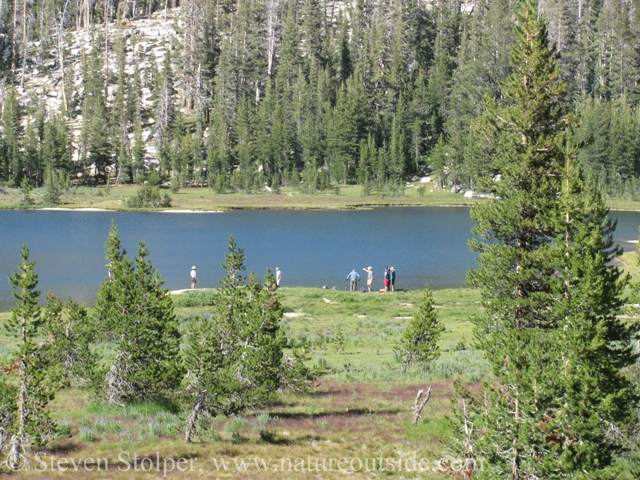
Tenaya Lake shallows
Tenaya Lake is surrounded by dramatic domes
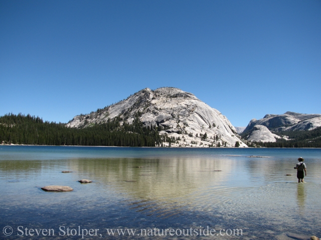
Ranger James wades toward the low flat rock in the distance
The lake is named to honor Chief Teneiya, of the Ahwahnechee. His was the last tribe to inhabit Yosemite. Counseled against the Spaniards by an elder, he fought them until his death in 1853. Many features in this part of the high country bear his name. Ranger James told us that he once encountered descendants of Chief Teneiya visiting the lake.
Bewildering Bonk
We enjoyed lunch on the rocks, dangling our legs in the cool water. But soon we set off to continue our journey. Almost immediately we encountered a challenging 1.5 mile climb up an almost vertical looking ridge. Switchback after switchback presented itself. At each turn another steep grade led to yet another switchback.
I was never a big fan of the term, “bonk.” But I can’t think of a better word to describe what was happening to me. I usually charge up hills eager to prove my worth against the terrain. But every so often things go amiss. This was one of those times. My breathing became labored and my calf muscles screamed in protest. My progress slowed to a crawl like a car running on fumes. I employed the rest step, pausing every few paces to relax my uphill leg and lock my downhill one. This gave my leg muscles a momentary respite as the bones of my locked leg took my body weight.
Others had difficulty with the climb as well. But none were so affected as me. I started the climb leading the pack but was one of the last ones to finish. Thank goodness there were no elderly ladies on the trail that day to zip by me with their walkers! 😀
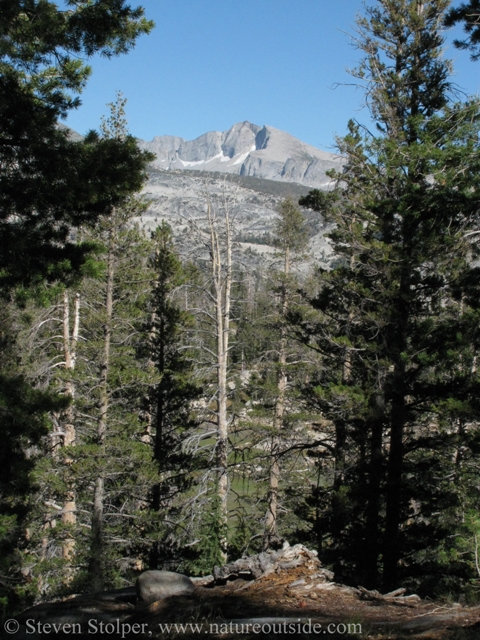
At the top of our climb we reached Clouds Rest trail junction. We left the trail at this point and headed west along the ridge. After about 100 yards we broke out onto a rock formation with commanding views of Half Dome, Tenaya Canyon and parts of Yosemite Valley.
Ranger James drew our attention to Tenaya Canyon, a broad granite valley with a precipitous drop at the end. He mentions that hikers are warned against the place because of its insidious nature. The terrain gradually steepens until the unwary descend to where they can’t go forward and it’s impossible to return. In their terrific book, Off the Wall: Death in Yosemite, authors Ghiglieri and Farabee tell several tails of hikes in Tenaya Canyon that conclude with sudden, unplanned accelerations.
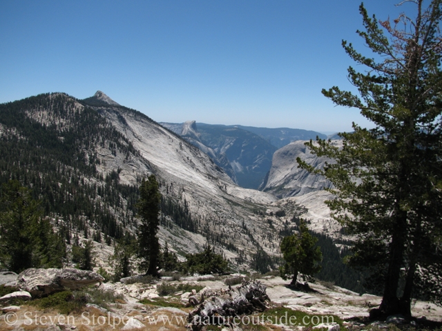
Tenaya Canyon with Yosemite Valley beyond. Half Dome is distant on the left.
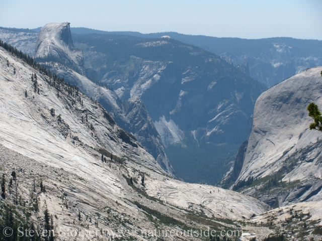
A closer look at the far end of Tenaya Canyon. It plummets toward the valley below.
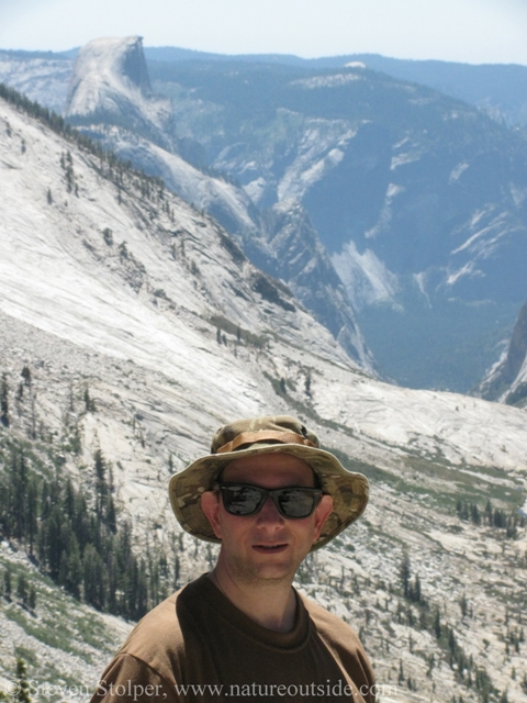
Me with Half Dome in the distance
The time at the lookout allowed the group to recover from the steep climb. Batteries recharged, we continued toward Sunrise Camp.
Old Trees and a Refreshing Swim
An interesting part of the trail descends along the length of a desolate, wind-swept granite slope. The trail is flanked by ancient juniper trees. These solitary guardians appeared to spring right from the rock itself. Many had roots that ran for a time over the surface of the stone hillside or crawled over small boulders. Their shapes were hauntingly beautiful. Twisted, deformed, scorched and stunted, the largest were little over 30 feet tall. But in such a bleak, inhospitable setting they gave off the feeling of great age. In fact many of these trees live for 1,000 years.
When I paused in the meager shade of the trees, I inhaled a vaguely familiar fragrance that I immediately recognized as juniper.
Continuing on, we hiked past the Sunrise Lakes. These are a group of three scenic lakes of varying size. Pausing at the last one, it seemed like a good time for a swim. One of our party began to fly fish, but there was little chance of landing “Moby Trout” with the rest of us splashing around. Eventually he joined us in the water. Just as we were toweling off, one of the remaining swimmers called in alarm. He had spotted a leach swimming toward him. It was time to resume our hike.
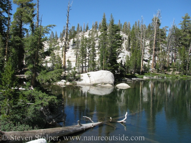
One of the Sunset Lakes
Taking a break from walking
Our group ready to leave the lakeside for the last leg of our journey to Sunrise Camp. Notice the scale of the terrain.
Sunrise Camp
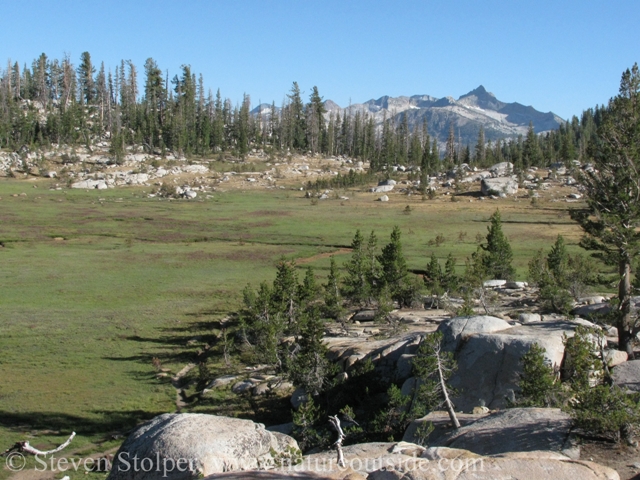
We climbed two more miles before descending to Sunrise Camp. The camp is perched above Long Meadow, a beautiful alpine expanse surrounded by granite peaks.
We stowed our gear and met up on the edge of the rock outcrop on which the camp sits. We passed the time until dinner chatting about the day while the sun sank in the sky. I felt a tap on my shoulder. One of my fellow hikers handed me a small cup filled with a colorless liquid. Sniffing inquisitively, I was startled to recognize the smell – junipers! Then I finally made the connection. Someone had brought with them a small flask of gin!
It was a powerful experience, “tasting the junipers” as the sun disappeared behind the granite peaks. To this day I keep a bottle of locally distilled Junipero gin in my home. Its taste is so evocative that I am instantly transported to that evening, sitting in the fading light above Long Meadow.
Trail to Long Meadow and Sunrise Camp
Long Meadow. The John Muir Trail runs through it.
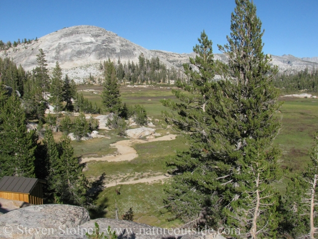
Long Meadow seen from Sunrise Camp. A camp storage shack is visible.
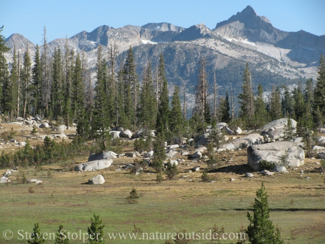
The meadow is surrounded by dramatic peaks
Next post…
The High Sierra Loop – Sunrise Camp to Merced Lake
The High Sierra Loop – Introduction
Day 0: The High Sierra Loop – Arrival Day
Day 1: The High Sierra Loop – Tuolumne Meadows to Glen Aulin
Day 2: The High Sierra Loop – Glen Aulin to May Lake
Day 4-5: The High Sierra Loop – Sunrise Camp to Merced Lake
Day 6-7: The High Sierra Loop – Merced Lake to Vogelsang
If you enjoyed reading this post, you may like other posts in the trips section.


I’m signed up to do the Glen Aulin-May Lake-Sunrise camps this summer (only 3 are open which is actually fine with me), I’m trying to figure out where I’ll park and where I’ll end up. Is there a trail from Sunrise back to Tuolomne assuming I park there? They haven’t given me any details yet. (Also I’m a little nervous about that May Lake – Sunrise leg, it looks strenuous! I’m going to have to get in shape for this!)
Jay, I did find the May Lake to Sunrise lake strenuous. The part that gave me trouble was the climb from Tenaya Lake.
There is an 8-mile trail from Sunrise back to the Tuolumne Meadows visitor center. The trail passes Cathedral lakes so I suggest you do some research and check the elevation gain between Sunrise Camp and the lakes to see if it is too strenuous.