
Picking up dinner along the way
This post is part of a series about my hike on Yosemite’s High Sierra Loop.
Glen Aulin to May Lake
Starting Elevation: 7800 ft. (2378 m)
Ending Elevation: 9270 ft. (2825 m)
Approximate Mileage: 8.5 miles (13.7 km)
Rise and Hike
Our group awoke early to consume the hearty breakfast served in the dining tent. As the sky brightened, we readied ourselves for the trail. In a scene that must play out most mornings at the camp, we adjust our packs, check our water bottles, and stride out into the chilly air.
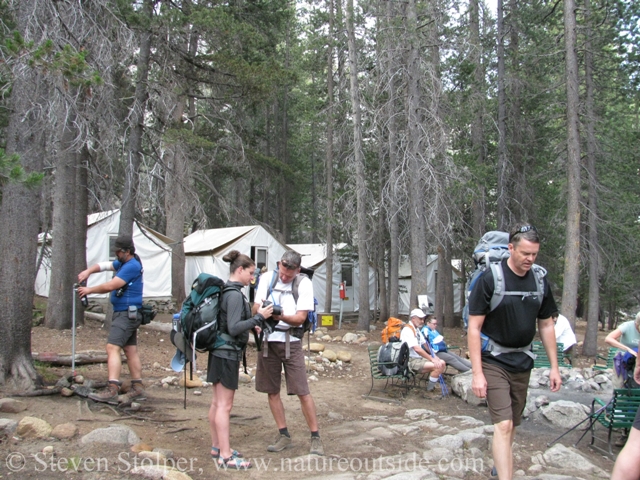
Guests preparing to depart
Behind us you can see a row of tent-cabins. Each holds four sturdy bunk beds, a small card table, and a wood-burning stove. None of us had given much thought to how the temperature drops in the Sierra overnight. So we didn’t light the stove the night before. Big mistake! We all spent a restless night tossing and turning in the cold air. The wool blankets on the beds were simply not enough. From then on we learned our lesson. One of us would always have the stove burning before bedtime.
Lodgepole Forest
Drawing by Natural Resources Canada.
We climbed out of Glen Aulin and into the morning sun. The steep climb warmed us immediately. Our ascent took us through a lodgepole pine forest and Ranger James gave a tutorial on how to identify conifers.
Lodgepole pine is one of the most widely distributed tree species in western North America. It extends from Alaska south to Mexico and east to South Dakota. Lodgepole pines grow straight, tapering to thin, narrow crowns. As its common name implies, they were used by Native Americans in the construction of their lodges.
These were Sierra lodgepole pines (Pinus contorta var. murrayana), which can grow to 80 feet tall. I think they are one of the easiest trees to identify. Their cones are small, about 1.2 – 2.4 inches long. The wider rounded ends grow flush against the trees’ branches without any apparent stalk to attach them. The pointed ends of the cones angle away from the branches. This arrangement is easy to spot at a distance.
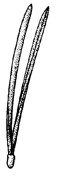
But for me, the needles are the giveaway. There are two needles in each fascicle (bundle). If you spread the needles apart to a 90-degree angle, you see the letter “L” for lodgepole pine.
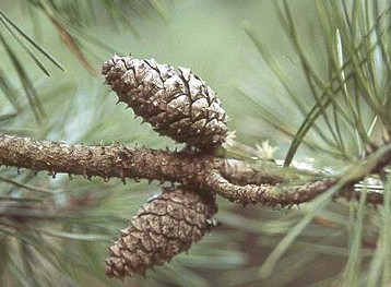
Photo by Oregon State University, Dept. of Horticulture.
Yampah Encounter
The ground was moist and covered with grasses. It was here that I first saw the plant, Yampah (Perideridia sp.), a member of the carrot family. Ranger James drew my attention to it and mentioned it is edible. Although I generally choose not to consume members of the Apiaceae family, I made a note to research the plant. Years later, I started consuming Yampah and have written posts about harvesting and preparing the plant.
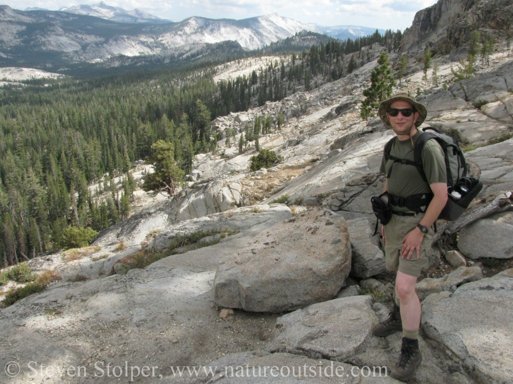
Dinner along the way
We stopped at McGee Lake in the early morning. The low clouds and stillness of the air lent a heavy, mystical quality to the water. The muggy weather was ideal for the millions of mosquitoes that drove us unceremoniously from the lakeside.
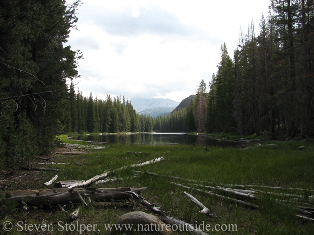
McGee Lake in the morning
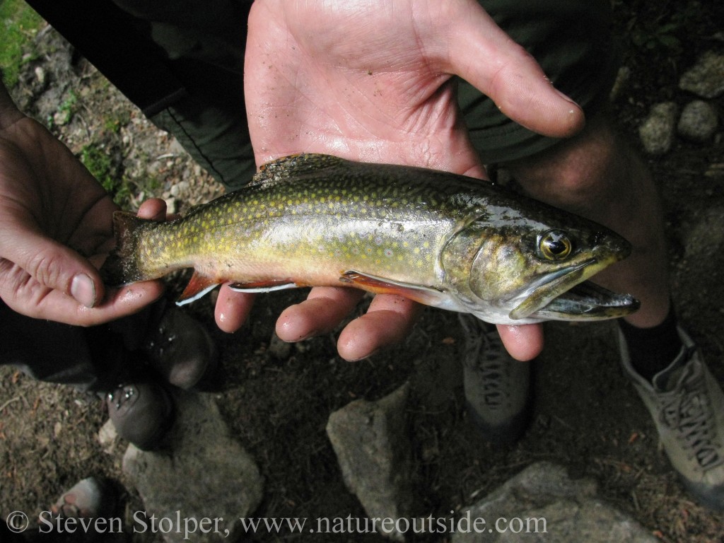
As we continued our climb, we followed a river that tumbled downward in the direction we came. At a stream crossing, Ranger James whipped out his fly rod and began to prowl the bank. There was not much water, only a few pools seemed capable of sheltering any fish worth a worm. But something caught his eye. He cast his line, moved, and cast again. Suddenly, we had a fish for dinner – a small brook trout (Salvelinus fontinalis).
Brook Trout (Salvelinus fontinalis)
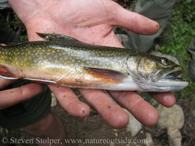
Brook trout are an invasive species introduced in 1871
What a pretty fish! I admit, this was the first time I viewed fish as distinct species that, like birds, have unique and interesting coloration.
What James did next surprised me. He gutted the fish but he did not wrap it and store it in his pack. Instead, he cut a hook from the branch of a nearby bush. He inserted the hook through the fish’s mouth to fashion a convenient carrying handle. He explained that he wanted the fish exposed to the air as we hiked. It would dry out and “seal” in its flavor. I am not a fisherman and cannot explain the theory. All I knew was that a member of our party was now carrying a dead fish through bear country. Bear jokes consumed the next 15 minutes of our hike. 🙂
Heavenly Views, Hellish Switchbacks
James warned us about the climb. We had emerged from the mixed conifer forest and wet meadows back onto imposing granite. The trail climbed steeply as we negotiated seemingly endless switchbacks. Our neophyte legs squealed like a loose alternator belt. We were hot, tired, and the “Check Engine” light had been on for the last two miles.
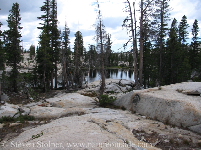
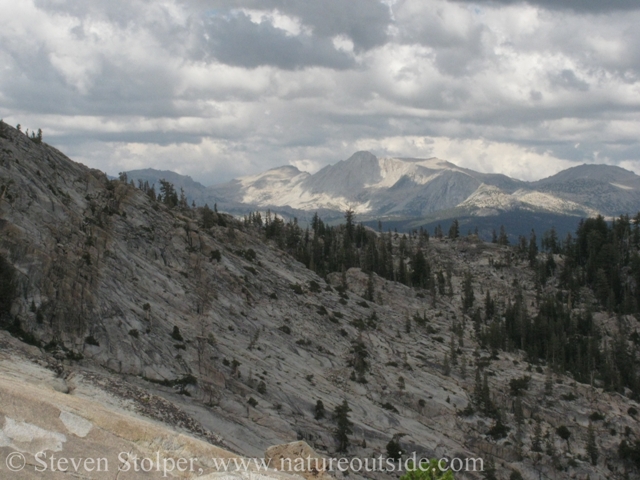
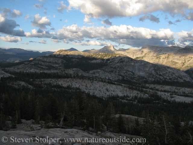
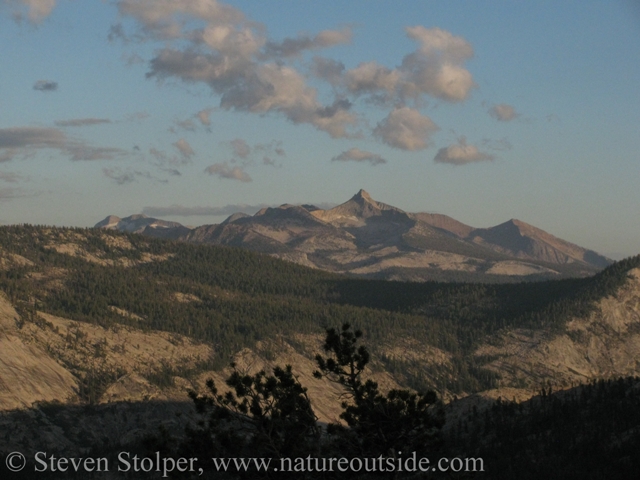
Halfway through the climb a small, clear lake provided respite and a brief swim. But after the brief pause, we resumed our climb. Those of us with enough energy to look around were treated to spectacular panoramas of Southern Yosemite. If I remember correctly, these first pictures are of the Sierra Crest (Mt. Conness and Mt. Dana).
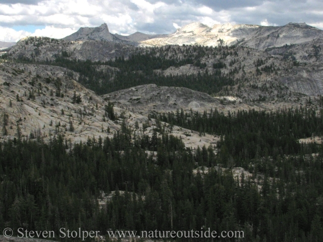
Mt. Conness and Mt. Dana (?)
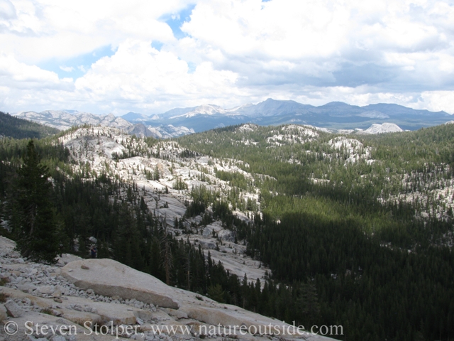
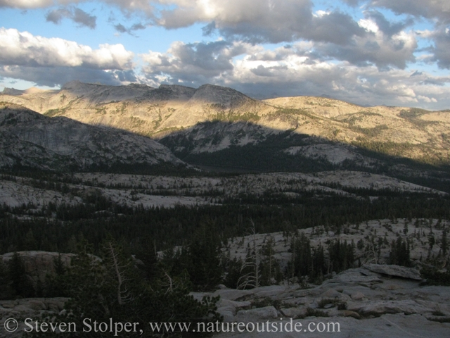
Sweeping views
The scale of this terrain is beyond words
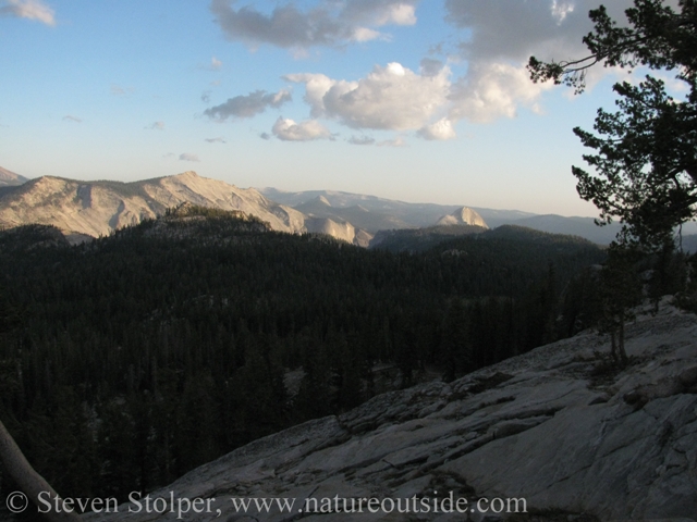
A cool mountain lake
The view from the ridge
Sunset at May Lake Camp
After cresting the ridge we coasted into camp. We arrived hot, dusty, and spent. The cool lemonade awaiting us in the dining tent quenched our parched throats and restored some of our energy. By the time we established ourselves in our tent-cabins it was time to join the other guests at dinner. I was ravenous!
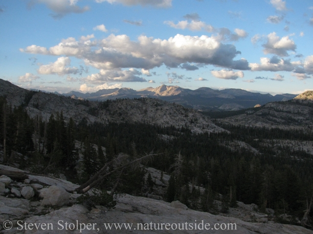
We felt much better after dinner. Ranger James led us onto a huge spine of rock overlooking a magnificent valley. We could see all of south and east Yosemite from our vantage point. The back side of Half Dome rose in the distance. On the far side of the valley a smaller ridge concealed Vogelsang, our destination 4 days from now. It was exciting to realize that during the next few days we would descend from our ridge, cross the valley, and end up high in the mountains on the far side.
We talked quietly as the sun approached the horizon. The air was calm with an expectant silence, like that moment in a theater between the house lights dimming and the conductor’s down-stroke. Then, slowly, we were treated to a kaleidoscope of oranges and yellows playing across the granite faces to our east. It was the best sunset of the trip.
Awaiting sunset
Sunset approaches
Colors at sunset
The back side of Half Dome in the distance
Evening settles on the mountains
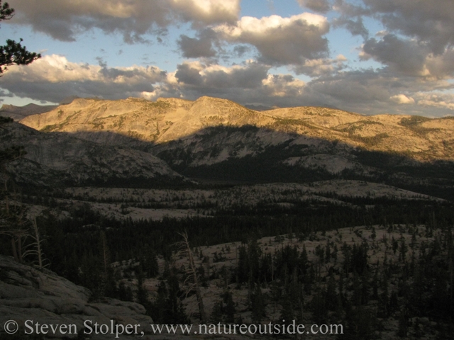
Colors and shadows
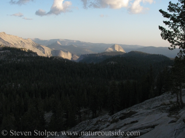
A closer look at the back side of Half Dome at sunset
We went to sleep tired, but pleased with the day’s accomplishment. Little did we realize that tomorrow would be one of our most challenging hikes of our journey.
Next post…
May Lake to Sunrise Camp
The High Sierra Loop – Introduction
Day 0: The High Sierra Loop – Arrival Day
Day 1: The High Sierra Loop – Tuolumne Meadows to Glen Aulin
Day 3: The High Sierra Loop – May Lake to Sunrise Camp
Day 4-5: The High Sierra Loop – Sunrise Camp to Merced Lake
Day 6-7: The High Sierra Loop – Merced Lake to Vogelsang
References
Sierra Nevada Natural History, Tracy I. Storer, Robert L. Usinger, and David Lukas, University of California Press, 2004
U.S. Forest Service Website (lodgepole pine)
If you enjoyed reading this post, you may like other posts in the trips section.


Leave a Comment